Fuel Center
I like maps. Real ones, I mean, printed on paper with holes worn in the folds. My preferred way to travel is to chart my own path from one of these maps, and I am almost positive that I am better at figuring a route than the navigation system in my car could ever be.
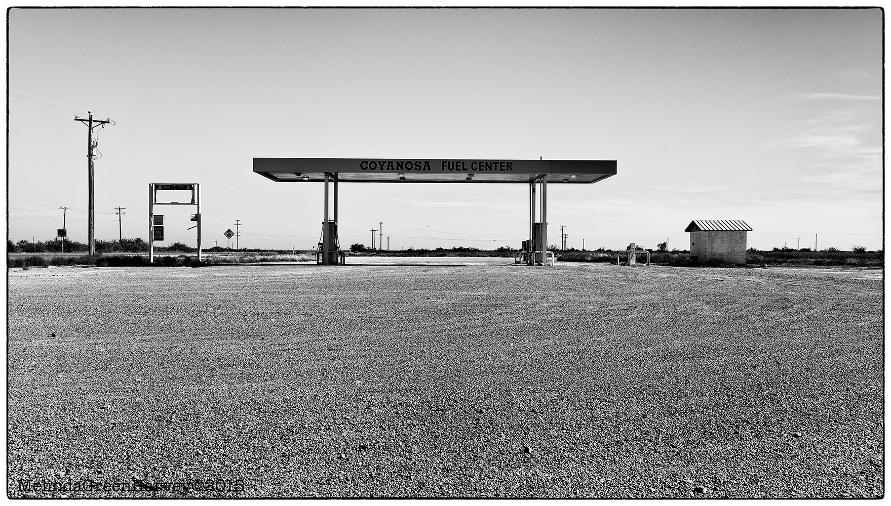
But the other day, I decided to take a route that my car suggested. It was completely out of character for me, and I can’t really explain what happened. Maybe I needed that weekend away more than I realized! At any rate, the nav system sent me through the tiny town of Coyanosa, which I’d never even heard of before. It was a good route – nice road, almost no traffic, and even some things to photograph, like this out-of-business fuel center. I am trying to convince myself that I could have found this route on the map, without satellite intervention….
Coyanosa, Texas
photographed 7.12.2015
Posted on July 26, 2015, in Photography and tagged 365 photo project, black and white photography, Coyanosa Texas, industrial architecture, melinda green harvey, monochrome, NIK Silver Efex Pro 2, one day one image, photo a day, photography, postaday, texas. Bookmark the permalink. 4 Comments.

Paper maps? They still print those things? My car doesn’t have a nav system. My phone does but I don’t trust it in my part of the world. Perhaps I will come to. I do use the chart program for navigation on the water and it is better in many ways than paper charts.
LikeLike
Yes, they DO still print paper maps, but only the Olds, like us, can use them…
Yesterday, on our first day exploring Novs Scotia, we used the paper map almost all the time, and only resorted to looking at the phone a couple of times.
LikeLiked by 2 people
I usually use a combination of paper maps and either phone or Garmin. The last time I didn’t refer to both, we took an hour detour in the wrong direction.
LikeLike
Weill, I hope that you saw something fascinating and unexpected during your extra hour of travel!
LikeLike