Monthly Archives: February 2017
Toward the light. But also toward the storm.
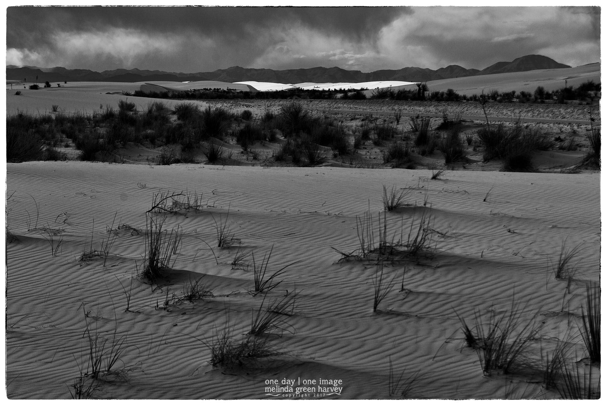
A few years ago, my friend Martha and I decided to drive from El Paso, where we were spending the weekend, to White Sands National Monument. That’s about a hour-and-a-half of driving.
Normally.
We left right after breakfast. Instead of taking the Interstate, we went on New Mexico highway 28, a noted scenic route. That should have added about 30 minutes to our trip.
Normally.
But we stopped. We stopped to look at an adobe barn. A pecan orchard. A church. We stopped in a little town where the church was having a festival*. We stopped for lunch. And etc.
So by the time we eventually made it to White Sands, it was very late in the afternoon. Most of the day’s visitors had already left. But the storm clouds were still hanging around, and the sun obligingly lit a band of sand in the distance.
White Sands National Monument
near Alamogordo, New Mexico
photographed 5.1.2010
*At the town with the festival, we were turned away from a parking lot that was, we were told, for church members only. We weren’t sure what identified us so readily as non-members, although we did come up with several options.
The Corral
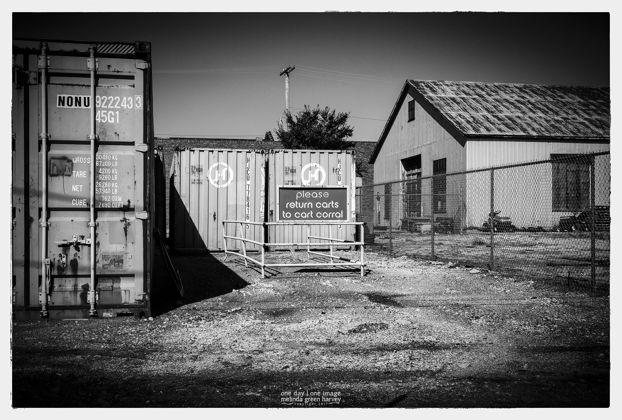
I guess there aren’t that many places across the country where the term “cart corral” makes sense. I would have anticipated that the middle of Nebraska would have been one of those places, but this one was left in a surplus yard. And there weren’t any carts around.
Hastings, Nebraska
photographed 8.30.2014
In the cradle of the valley’s hand
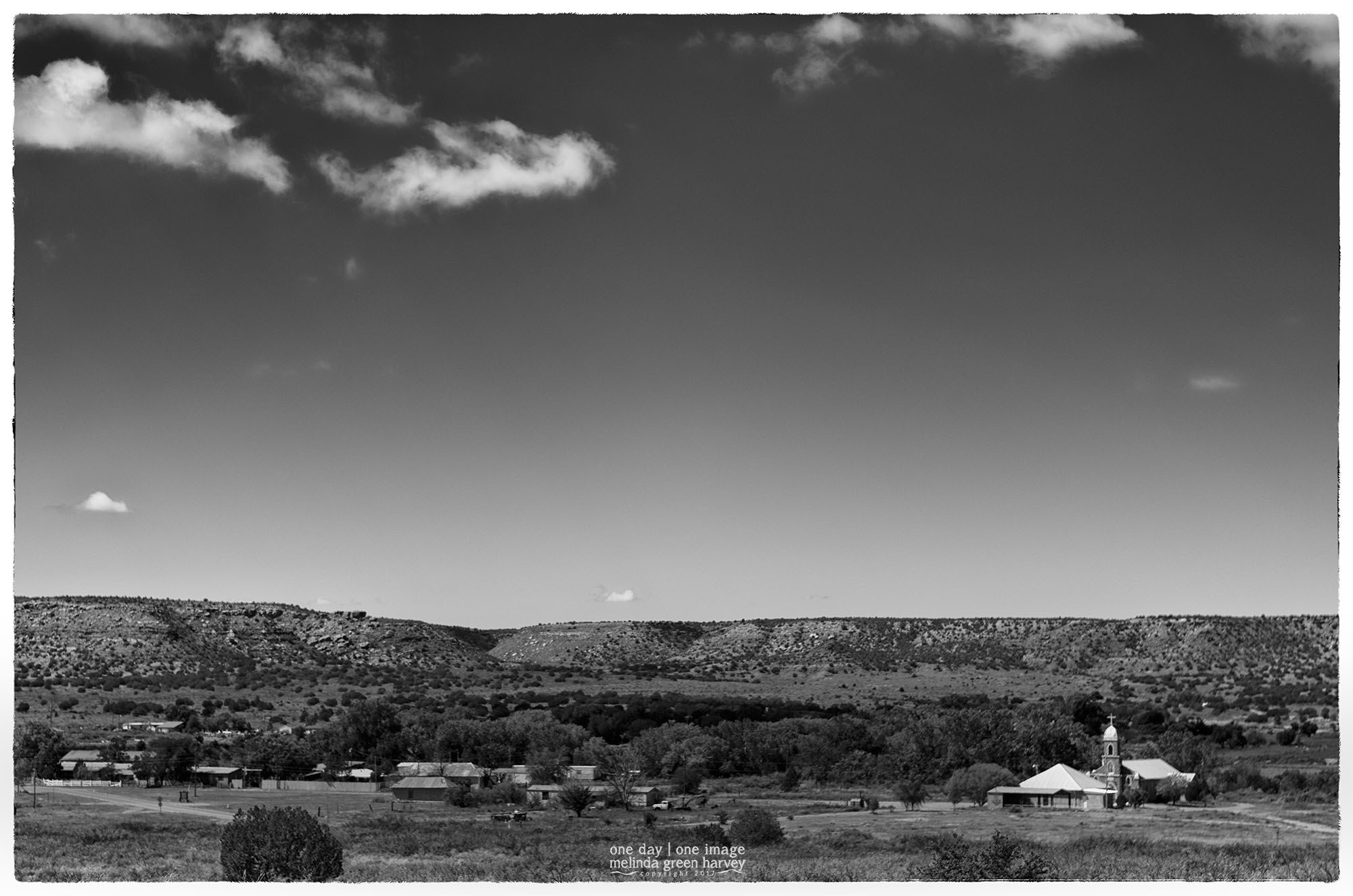
You have to be going there on purpose, to this tiny town on the banks of the Pecos River south of Santa Rosa. It’s so unknown that Google maps will either direct you to Luna, New Mexico, which isn’t it, or will send you to what looks like more-or-less a random location. The only way I even knew about it was from reading one of those cheerful “Welcome to Santa Rosa” booklets once at a restaurant. (If you want to go, just take South 3rd Street from downtown Santa Rosa. It’ll change names to State Highway 91, County Road 2P, and County Road 3C by the time you get there.
This is the view from a little cemetery on a hill east of town.
Puerta de Luna, New Mexico
photographed 9.21.2013
And the road, not traveled
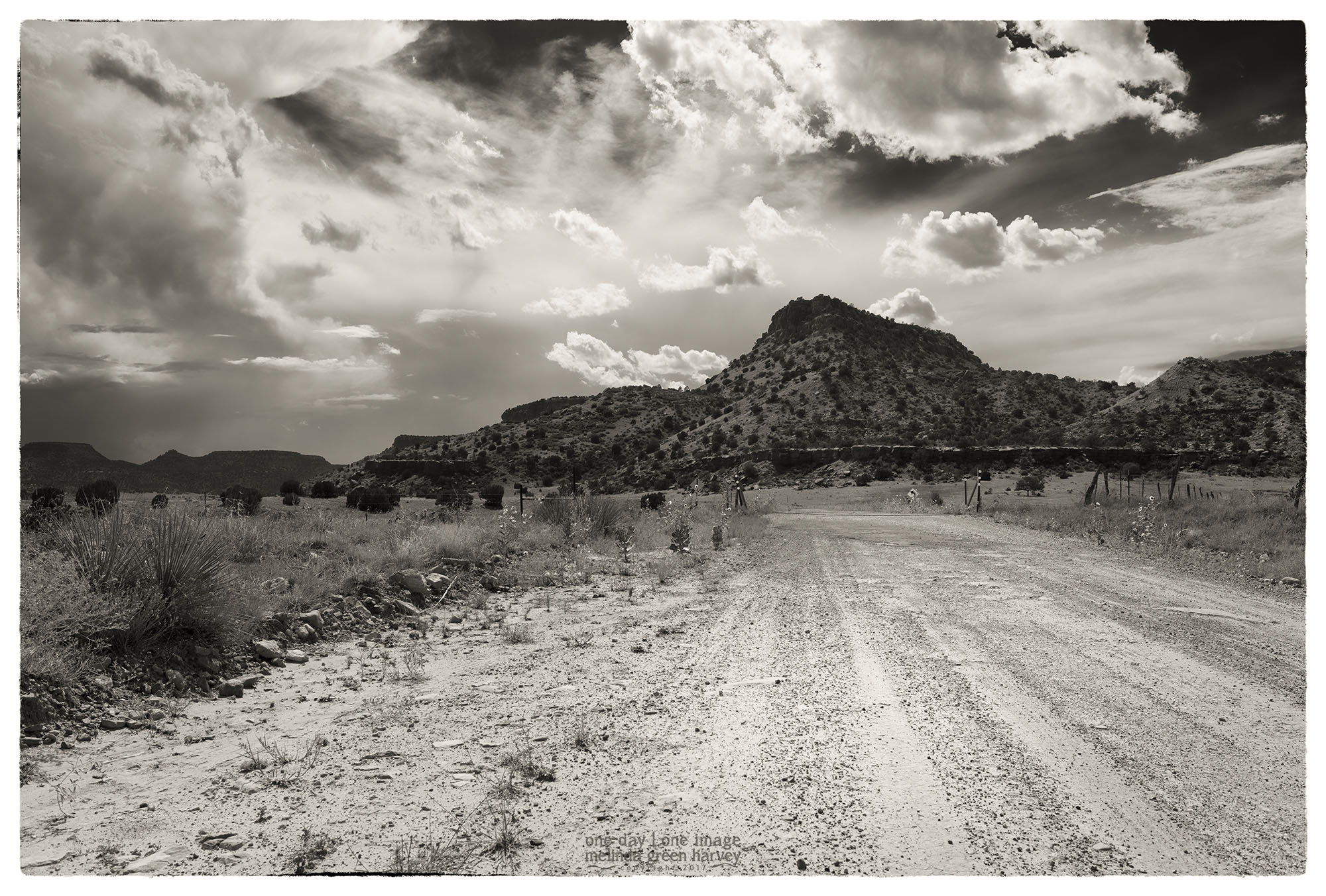
There are a few options if, for some reason, you want to travel between Branson, Colorado, and Kenton, Oklahoma. You can take regular, paved roads. One choice would take you north through Kim, Colorado; that’s about 100 miles, and Google thinks it’ll take a couple of hours to drive it. You could also take a wide swing to the south, through Folsom, New Mexico and the Santa Rita National Grasslands before heading back to the north to Kenton. That way’s also about 100 miles, with the same travel time.
Then there’s this route, where as soon as you clear Tollgate Canyon on the Colorado-New Mexico line, a left turn will put you on a route 456. It’s 62 miles to Kenton, with a Google-estimated travel time of 2 hours. Yep. That’s the way to get to Kenton.
Union County, New Mexico
photographed 9.5.2016
Cooler

Of course, my traveling companion was looking at fruit when we stopped at the fruit stand. I, on the other hand, was predictably distracted by the well-worn walk-in cooler.
(We did get some delicious cantaloupe, though. No thanks to any effort on my part.)
Rocky Ford, Colorado
photographed 9.4.2016
