Blog Archives
yet despite all this
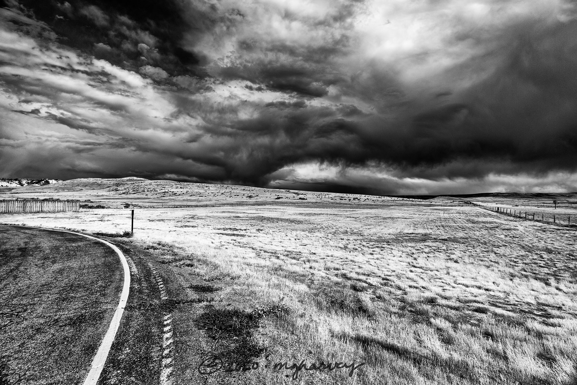
Normal travelers seeking a route between Cheyenne and Caspar would take Interstate 25, which would take about two and a half hours.
And that is the complete explanation of our route of choice, a desolate and meandering path that added roughly an hour to the drive. But we got to see this. (And we skipped the boring interstate.)
Shirley Rim Rest Area, Wyoming
photographed 8.27.2020
H
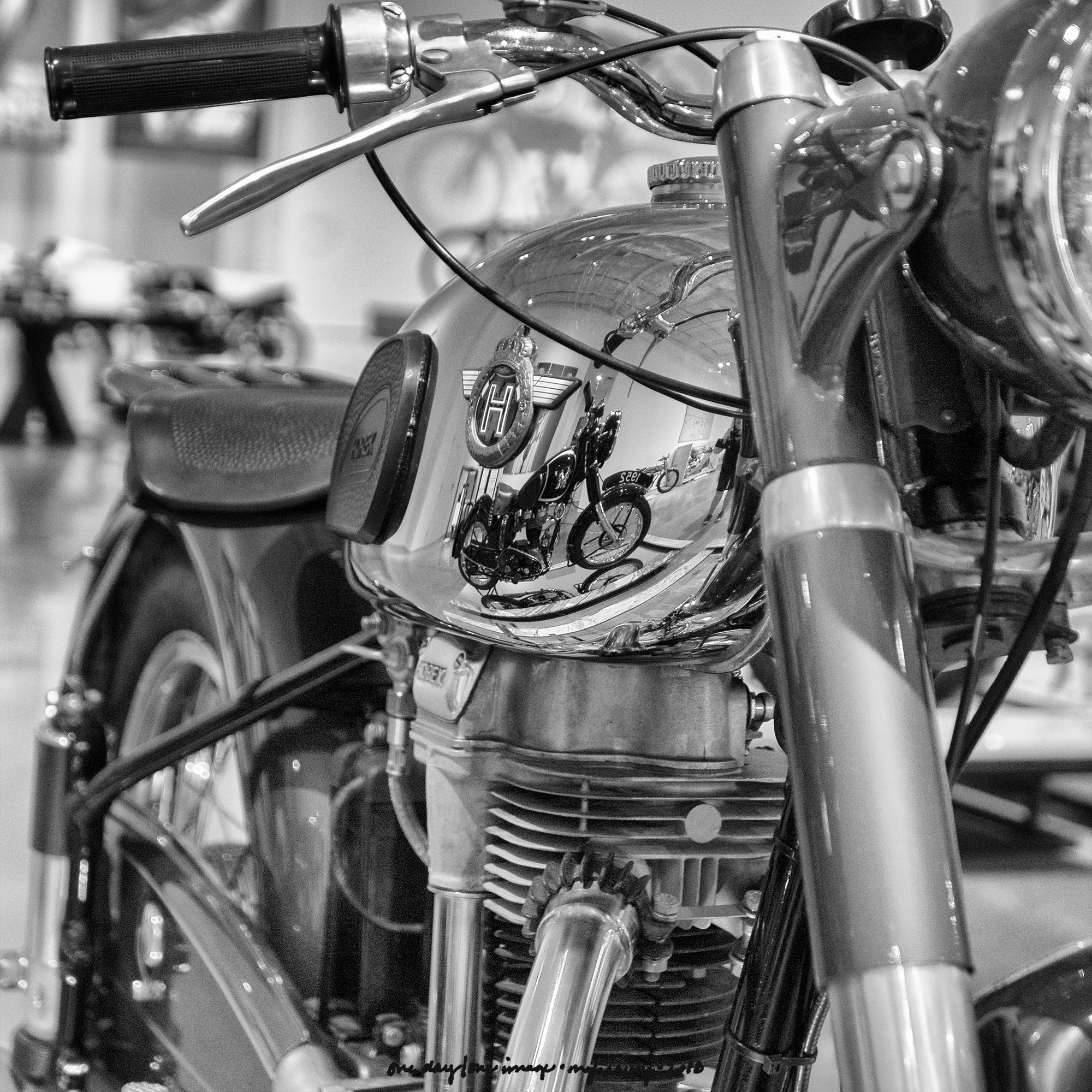
Yes, a motorcycle.
But before we get to that, go here and check out those aerial images. You may have seen them before in National Geographic or something. Take as long as you want; I’ll wait.
…
…
…
So, that photographer is also the genius behind this amazing collection of motorcycles. The Patient Spouse and I spent an enjoyable couple of hours here the other day, making the $10/person entry fee the very best bargain in all of Dallas. There were two friendly employees who were more than happy to talk about the motorcycles as long as we wanted, but were also happy to leave us alone, too.
And I didn’t even LIKE motorcycles before I visited this place…
Haas Moto Museum
Dallas, Texas
photographed 6.1.2018
Week of Randomness: Fenceline
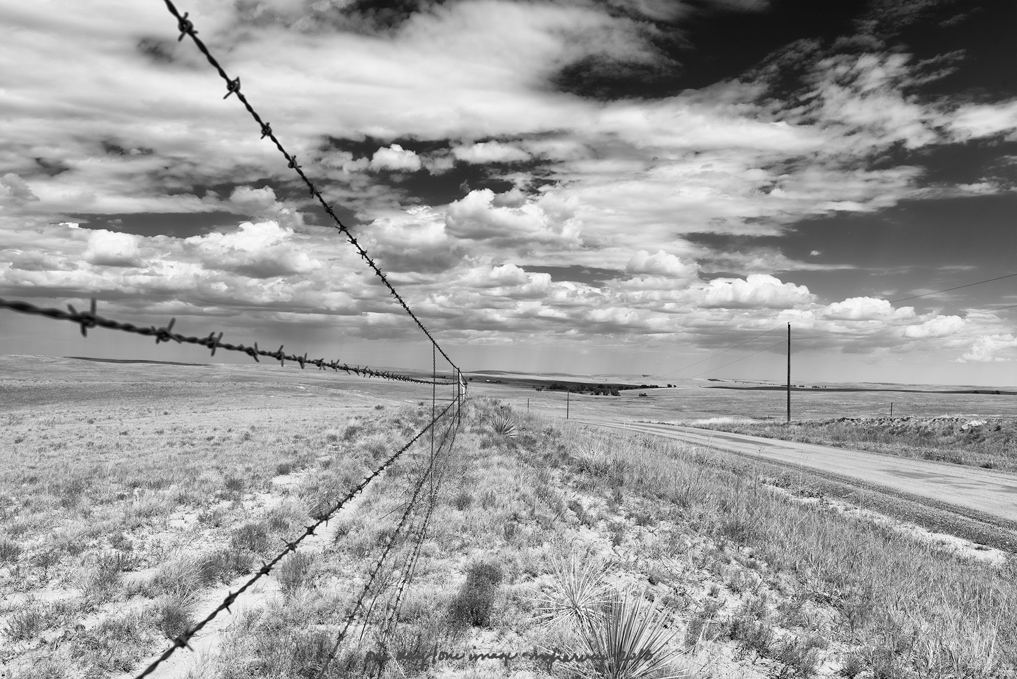
For reasons that were inexplicable and non-negotiable I decided that a driving trip from Lubbock to Denver would not include a single mile driven on a Interstate highway.
It takes me practically forever to get anywhere anyway (because: photography). Add that to the driving conditions (not all the roads were paved, for example), and I think our travel speed was somewhere in the covered-wagon range.
But I saw this.
Ebert County, Colorado
photographed 9.4.2016
Cyril and Methodius, the cemetery saints
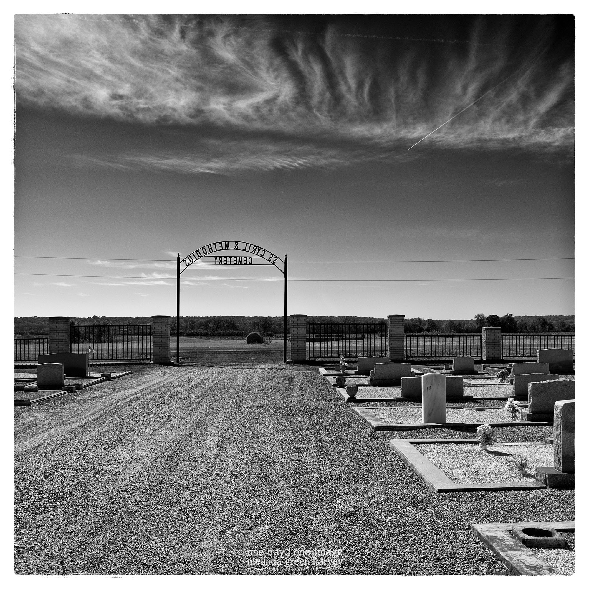 A long time ago, I discovered a great atlas called The Roads of Texas that was published by Texas A&M University. It had large-scale maps of the entire state, and I used it until it literally fell apart. I’ve got a new version now, and use it often to scope out road trips*. In addition to having ALL the roads in the state, it details the sorts of things I like to look at.
And that’s how I found the Saints Cyril and Methodius Cemetery.
(In case you were wondering, the saints were brothers, born in Greece in 826 [or 827] and 815; in 1980, they were declared as co-patron saints of Europe. They are highly regarded by Roman Catholic and Orthodox Christians.)
And I – and now you, maybe – would never known any of this except that I saw the cemetery in the atlas.
near Buckholts, Texas
photographed 11.25.2017
*I know – I’m old school like that with my paper maps.
And the road, not traveled
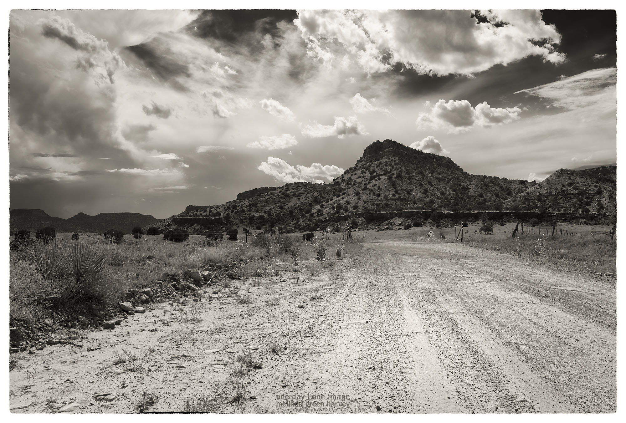
There are a few options if, for some reason, you want to travel between Branson, Colorado, and Kenton, Oklahoma. You can take regular, paved roads. One choice would take you north through Kim, Colorado; that’s about 100 miles, and Google thinks it’ll take a couple of hours to drive it. You could also take a wide swing to the south, through Folsom, New Mexico and the Santa Rita National Grasslands before heading back to the north to Kenton. That way’s also about 100 miles, with the same travel time.
Then there’s this route, where as soon as you clear Tollgate Canyon on the Colorado-New Mexico line, a left turn will put you on a route 456. It’s 62 miles to Kenton, with a Google-estimated travel time of 2 hours. Yep. That’s the way to get to Kenton.
Union County, New Mexico
photographed 9.5.2016
