Blog Archives
bois d’arc series #1: “welcome”

I’m sort of right in the middle of an inadvertent series of botanical images. Somethings things just line up on their own…
Anyway, out on the highway between Levelland* and Whiteface* there’s a picnic area with a mile-long row of bois d’arc trees behind it. As far as I know, these are the only bois d’arc trees I’ve ever seen, but I’d read about them in the book PrairyErth: a deep map (William Least Heat-Moon) and recognized them from the description stored in my head.
Prior to the introduction of barbed wire, bois d’arcs were in common use along fencerows. As barbed wire become more common, this particular use of the tree declined. The Dust Bowl caused a resurgence in their use: beginning in 1934, the Works Progress Administration planted over 200 million trees on farmland to serve as windbreaks to prevent soil loss. My guess is that this particular row of trees was planted during that era.
The (inedible) fruit from these trees has several names, including Osage orange, horse apple, and hedge apple. The vernacular pronunciation is “bodark.”
Hockley County, Texas
photographed 1.13.2024
*Actual town names.
Tiny Chapel
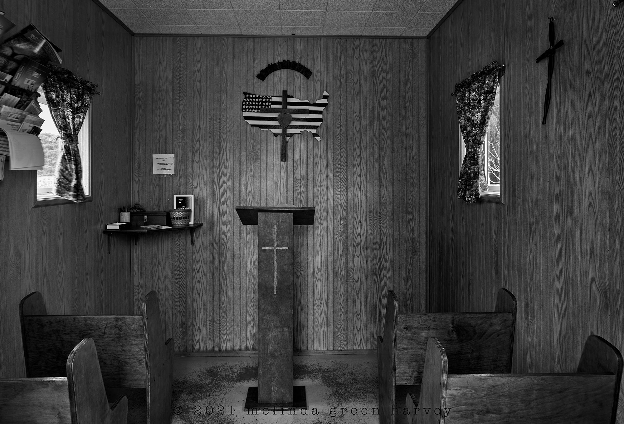
In 1991, I read William Least Heat-Moon’s book PrairyErth: A Deep Map, about the middle county in the middle state of the continental US, Chase County, Kansas. I read it with an atlas so I could follow along his deep explorations of the county. It’s a long book and I read it carefully; it made me re-think the way I looked at things I wasn’t even used to seeing (fence posts, for example, or a thicket of trees beside a stream). I am quite certain that this book influences my photography almost every time I pick up the camera, as it gave me the understanding that taking slow and deep looks into the mundane would yield great rewards.
Now, this tiny chapel at the geographic center is not in the same county where the book was set, but the visit here sent my mind thinking about the book for the rest of the day. And when I got home, I pulled it down from the shelf and put it in the reading queue: it’s time for a new look at this particular old friend.
at the geographic center of the continental United States
near Lebanon, Kansas
photographed 12.11.2020
Snake River Hills

You know that I am primarily a b+w photographer. But the color of that water, though….
Maybe if you’re looking for something to read, you’d like River-Horse: a Voyage Across America, by William Least Heat-Moon. I read it, with an atlas at hand to follow the journey, when it was published in 1999. The day I made this image, I started to wonder if Heat-Moon had been along this part of the Snake River; it took me a couple of weeks after I got back to get around to finding the book on my crowded and unorganized book shelves, and I learned that he was indeed here. Here’s part of what he said, some of the loveliest words I’ve read in a while:
The shores rose steeply a few hundred feet into basins of basalt broken by fallen ramparts of volcanic crust and long ledges weathered into delicate traceries like petticoat hems or coarsely eaten into lacunas and strange shafts, the canyon virtually devoid of anything human but an empty rail line and impounded water.
– William Least Heat-Moon
along the Snake River, Washington
photographed 9.4.2020
PS: If you liked that quote from River-Horse, let me also recommend his books PrairyErth: A Deep Map and Blue Highways: A Journey Into America. (I read both of those with an atlas at hand, too.)
Facing the tracks

Dime Box, Texas, is not the funniest town name in America. Traditionally, that honor belongs to Intercourse, Pennsylvania. I prefer Scratch Ankle, Alabama, Gnowbone, Indiana, or even Humptulips, Washington. Nevertheless, Dime Box, as a name, caught my ear, so that’s where I headed the next morning out of College Station.
– William Least Heat-Moon, Blue Highways
Even though William Least Heat-Moon’s visit to Dime Box was written a while back (Blue Highways was published in 1982), much of his description of the town sounded as though he’d been there earlier the same day as my visit. For example, he describes this scene as “worn brick buildings facing the Southern Pacific tracks.” Maybe that bright aluminum door has been added since his visit, but my guess is that the rest of the block looks much the same as it did the day he drove over to Dime Box from College Station.
Dime Box, Texas
photographed 2.28.2014
