Blog Archives
half-way
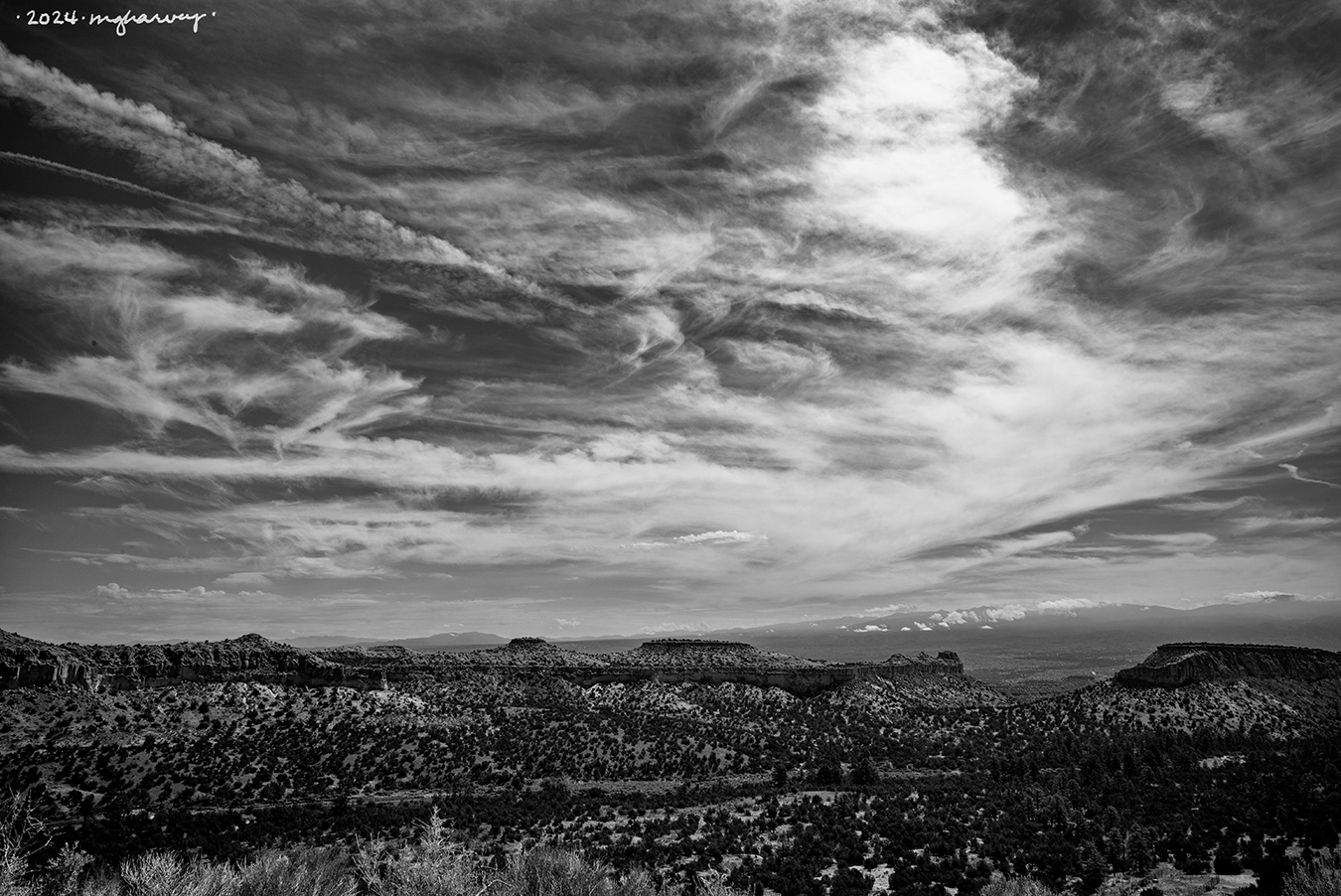
About half way up the drive to Los Alamos there’s a scenic pullout, and “normal” travelers might pull over long enough to take some selfies and/or glance across the landscape before they get back in their cars and resume the trip.
Photographers (who are almost never in the “normal” camp) will pull over, turn off the car, get out cameras and lenses and tripods and ND filters, and spent a long-ass time making photos.
In case you were wondering why it takes photographers practically forever to get anywhere.
between Pojoaque and Los Alamos, New Mexico
photographed 6.30.2024
dome + clouds
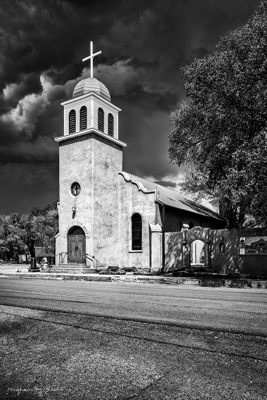
I can’t even count the number of times I drove right past the turn to Cerillos, but it’s equal to all the times I’ve driven the road, minus one: the last time there I finally made the turn. And obviously it was well worth it.
Cerillos, New Mexico
photographed 5.16.2022
Big Screen
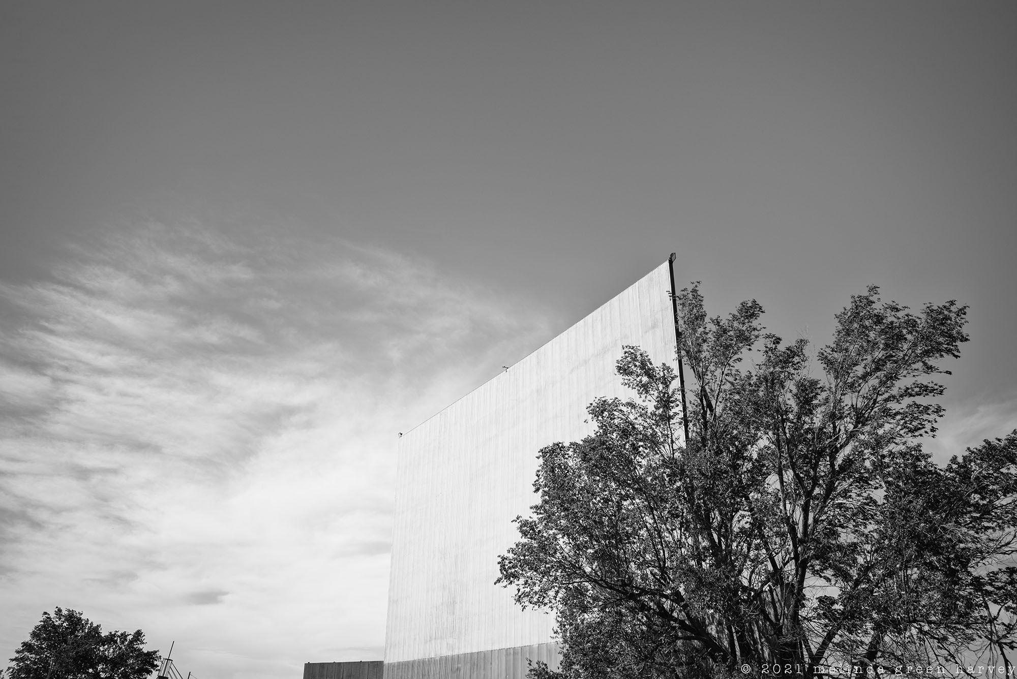
I thought about making myself believe that the screen was turning into a cloud and floating away.
Or, alternatively, that the cloud was solidifying itself and becoming the screen.
Either way was equally likely.
Lamesa, Texas
photographed 5.2.2021
Ancient Rocks and Air Travel
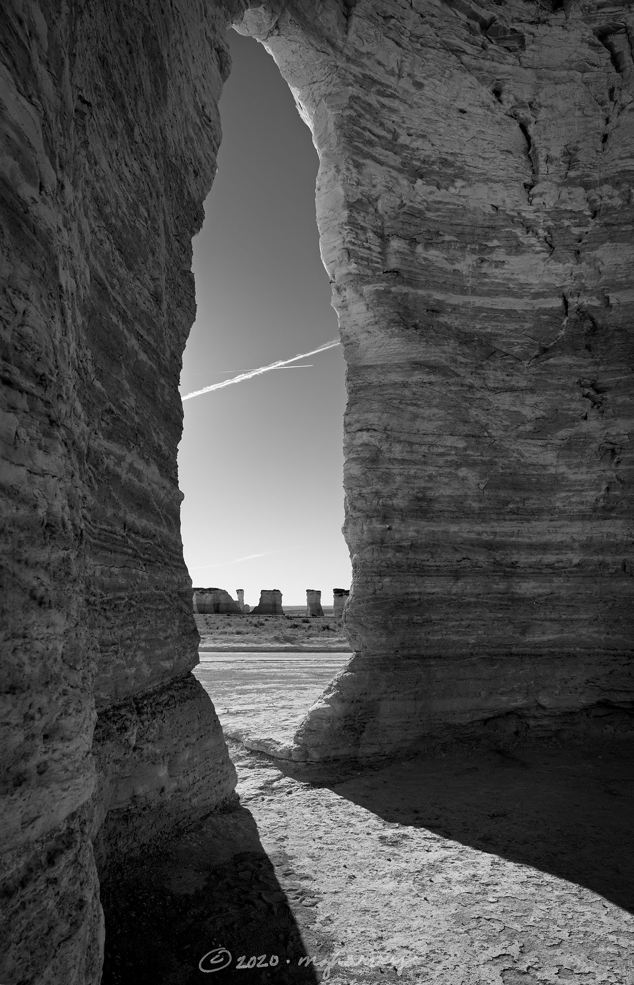
A friend of mine tipped me off about this otherworldly place; it’s just a few miles off the main highway but if you’re headed north, there’s not a sign to let you know it’s even there.
The middle part of the country is often referred to as “flyover country” and on this morning, the jets were busy doing just that.
Monument Rocks National Natural Landmark
near Oakley, Kansas
photographed 12.7.2020
yet despite all this
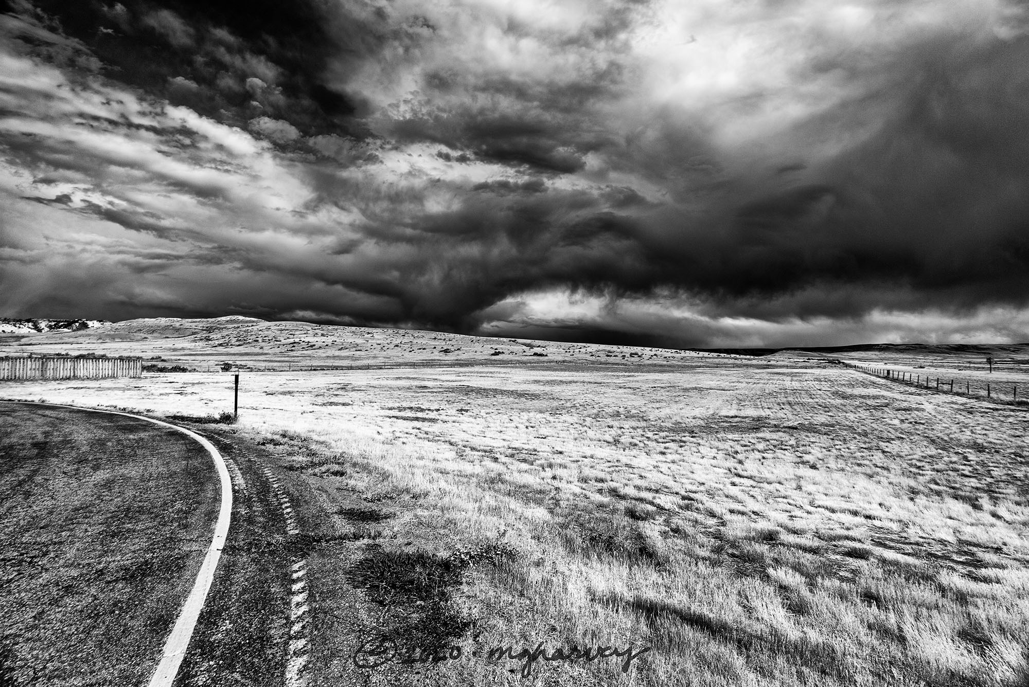
Normal travelers seeking a route between Cheyenne and Caspar would take Interstate 25, which would take about two and a half hours.
And that is the complete explanation of our route of choice, a desolate and meandering path that added roughly an hour to the drive. But we got to see this. (And we skipped the boring interstate.)
Shirley Rim Rest Area, Wyoming
photographed 8.27.2020
